
The argument over who gets the street has become sharper because the stakes are real. NHTSA reported 39,254 traffic deaths in the United States in 2024, including 1,103 bicyclists, and IIHS says more than 80% of pedestrian and bicyclist deaths that year occurred in urban areas. That means the hardest conflicts are playing out exactly where street space is scarcest: on city corridors that also need to handle turning cars, buses, deliveries, curb parking, sidewalks, crossings, and bike traffic. (nhtsa.gov)
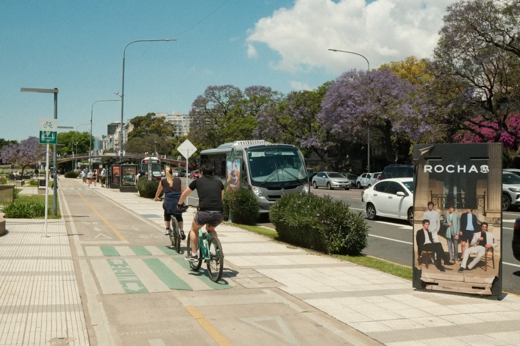
That is why the usual culture-war framing misses the point. Streets are not trophies for one mode. They are public systems that have to move people, allow access, and limit harm when human beings inevitably make mistakes. FHWA treats Complete Streets as part of a Safe System approach, which shifts the goal from maximizing vehicle flow at all costs to preventing death and serious injury for everyone using the network. (planning.dot.gov)
The real fight is over street function, not identity
Most public hearings still sound like a referendum on lifestyle. Drivers talk about congestion and parking. Cyclists talk about fear and access. Merchants talk about loading and customer turnover. Transit riders talk about unreliable buses. Residents talk about speeding. All of them are describing a real problem, but often from only one angle.
A better starting point is to ask what a particular block is supposed to do. Curbside guidance supported by FHWA puts the issue plainly: communities have to choose which modes to prioritize and whether a curb segment is being used mainly for storage or for mobility. That is a much more useful question than asking whether a street is “for cars” or “for bikes.” (itskrs.its.dot.gov)
The answer to “who should control street space?” also has to be split into three parts. Legally, street rules are mostly controlled by state and local agencies, while the federal MUTCD sets national standards for signs, signals, and markings. Operationally, transportation departments control lane assignments, curb rules, timing, and enforcement priorities. Politically, elected officials and the public shape the goals those agencies pursue. In other words, no single mode should “own” the street, but public agencies absolutely do decide how its space is allocated. (mutcd.fhwa.dot.gov)
Why the debate is getting harder, not easier
One reason is safety. FHWA’s Safe System primer explicitly starts from the idea that humans make mistakes and that vulnerable users absorb the worst consequences when the system fails. On top of that, IIHS research has found that vehicles with higher, blunter front ends are substantially more dangerous to people outside the vehicle; pickups, SUVs, and vans with hood heights above 40 inches were about 45% more likely to cause pedestrian fatalities than lower, more sloped cars in the study IIHS cited. When streets are designed around speed and forgiveness for drivers alone, those risks are pushed outward. (highways.dot.gov)
Another reason is that the curb has become crowded with competing uses. The same edge of pavement may now need to serve parking, freight loading, ride-hail pickups, accessible loading, transit stops, bike protection, and pedestrian visibility. FHWA-backed curbside management materials describe this as a prioritization problem, not a side issue. Once that is understood, the bike lane debate looks different: sometimes the true conflict is not bike space versus car travel, but bike safety versus free vehicle storage, or bus reliability versus unmanaged loading. (itskrs.its.dot.gov)
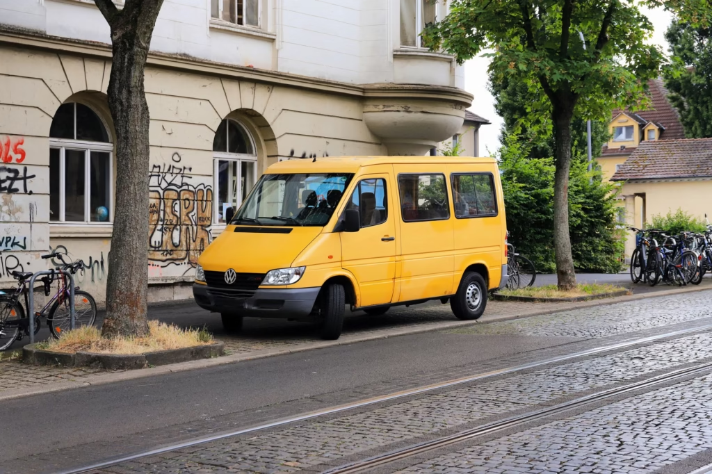
A third reason is that design expectations have changed. The current MUTCD applies to pedestrian and bicycle facilities as well as general roadways, and FHWA’s separated bike lane guidance treats intersections, driveways, transit stops, accessible parking, and loading zones as core design questions rather than afterthoughts. The old assumption that bikes can simply be squeezed into leftover space is increasingly hard to defend. (mutcd.fhwa.dot.gov)
A better way to decide: the Four-Lens Street Allocation Test
This is an editorial decision tool, not a federal standard. It is meant to help readers evaluate street-space proposals more clearly.
- Safety lens: If a mistake happens here, who is most exposed to serious injury? Safe System thinking says that question should come first, because vulnerable road users do not have the protection of a vehicle shell. (highways.dot.gov)
- Movement lens: Does the space move people efficiently, or mostly store vehicles? A full travel lane, a bus lane, and a parking lane do very different jobs even when they consume similar width.
- Access lens: Which functions truly have to occur on this block? Freight, disability access, emergency access, school pickup, and bus operations may require curb space even when long-term parking does not. (itskrs.its.dot.gov)
- Network lens: Is this segment a missing link? A single unprotected block can break an otherwise usable bike network, just as one bad loading zone can disrupt bus operations along an entire corridor.
What makes this framework useful is that it prevents the two most common mistakes. The first is treating current lane allocation as neutral, as if yesterday’s design choices are somehow apolitical. The second is treating any reduction in car priority as automatically virtuous. Good street design is not anti-car. It is anti-chaos.
What common street-space choices usually optimize
Not every redesign needs protected bike lanes, and not every street should lose a travel lane. But the tradeoffs are more predictable than public debate often suggests. FHWA says road diets on suitable four-lane undivided roads have been associated with a 19% to 47% reduction in overall crashes, while its separated bike lane guide emphasizes that protection only works when intersections, transit interfaces, driveways, and loading details are designed properly. (highways.dot.gov)
| Street allocation choice | Usually helps most | Best fit conditions | Main tradeoff if misapplied | What to check first |
|---|---|---|---|---|
| Keep general lanes and parking | Short-term vehicle access and familiar operations | Low bike demand, low pedestrian conflict, strong off-peak access need | Can preserve speeding, long crossings, and curb disorder | Crash pattern, speeds, turnover, double-parking |
| Painted bike lane | Basic route legibility for confident riders | Lower-speed streets with limited turning friction | May provide too little protection on fast or busy corridors | Operating speeds, truck volume, dooring risk |
| Protected or separated bike lane | Safety and comfort for a much wider range of riders | Urban corridors with sustained bike demand and frequent conflicts | Can create new turning and loading conflicts if details are weak | Intersection design, bus stop treatment, loading plan, driveway density |
| Road diet with center turn lane | Safer turning, calmer speeds, room for bike lanes or crossings | Four-lane undivided roads with conflict-heavy turning movements | Can add delay if traffic volume or signal timing is a poor fit | Traffic counts, turning volumes, parallel route effects |
| Dedicated bus or transit-priority lane | Moving large numbers of people reliably | Corridors with frequent bus service and recurring delay | Can feel politically costly if judged only by car delay | Bus frequency, stop spacing, curb conflicts |
| Loading and accessibility-focused curb zone | Deliveries, pickups, disability access, commercial turnover | Retail streets where curb friction is constant | Can fail if treated as overflow parking | Enforcement, hours of operation, turnover rules |
The important implication is that bike space and car access are not always opposites. A road diet can improve turning order for drivers while also creating room for safer bike movement. A loading zone can reduce double-parking that would otherwise block both buses and cyclists. A protected lane can work well on one corridor and badly on another if the intersection design is lazy.
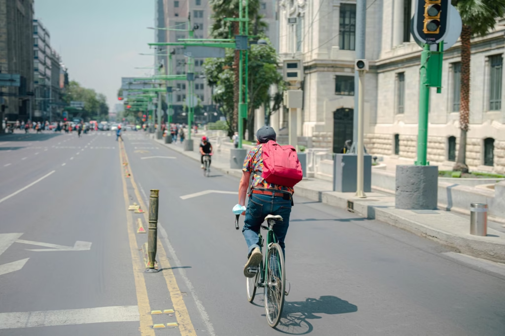
A realistic example: one corridor, two honest answers
Consider a hypothetical main street with four undivided travel lanes, curb parking, two bus stops, several restaurants, a school crossing, and visible bike traffic. Drivers complain about backups at left turns. Business owners complain about double-parked delivery vans. Parents complain that crossing feels dangerous. Cyclists say the painted shoulder is unusable.
Using the Four-Lens test, a strong answer might be a road diet: one general lane each way, a center turn lane, protected bike space, timed loading zones near the businesses, and shorter crossings near the school. That would not be because bikes “won.” It would be because the corridor’s real problem is conflict management. FHWA’s road-diet guidance says properly chosen four-lane undivided roads can see meaningful crash reductions, and its separated bike lane guide makes clear that the loading and intersection details have to be designed intentionally. (highways.dot.gov)
Now change the context. Make the same street a truck-heavy industrial connector with very few destinations, limited bike demand, and no realistic parallel freight route. The answer could shift. Better loading discipline, safer crossings at key points, and speed management might matter more than a full lane reallocation. The lesson is not that bike infrastructure is optional in some moral sense. It is that street decisions should follow function and risk, not slogans.
Where the debate usually goes wrong
- Mistake 1: Treating the existing street as neutral. A curb lane used for free or cheap storage is still a policy choice, not a natural law.
- Mistake 2: Assuming paint is enough. FHWA’s Safe System primer gives more weight to separating users in space than merely separating them in time, because time-based control depends more heavily on compliance. (highways.dot.gov)
- Mistake 3: Removing parking without replacing its function. If deliveries, pickups, or accessible loading still need to happen, unmanaged curb activity will spill into travel lanes and bike space. FHWA-backed curbside guidance specifically treats modal prioritization, performance measures, alternatives, and public feedback as part of the process. (itskrs.its.dot.gov)
- Mistake 4: Believing lower posted speed limits alone will solve the problem. FHWA says simply lowering the number on the sign does not guarantee drivers will slow down; design and speed-management countermeasures may be needed. (highways.fhwa.dot.gov)
- Mistake 5: Measuring success only by how fast private cars move. A corridor can become slightly slower for through-driving and still function better overall if crashes, blocked buses, illegal stopping, and crossing risk all fall.
How to evaluate a local street proposal without getting lost in rhetoric
- Watch the street at several times of day. A block that looks calm at 10 a.m. may be chaotic during school pickup or dinner delivery hours.
- Write down conflicts, not just volumes. Note double-parking, close passes, blocked bus stops, long pedestrian exposure, turning conflicts, and door-zone riding.
- Separate access from storage. Ask which uses genuinely need curb access here and which uses are mainly long-duration parking. (itskrs.its.dot.gov)
- Look for missing links. A safe bike lane that abruptly disappears before the hardest intersection is not a complete solution.
- Ask to see intersection and curb details, not only a cross-section drawing. FHWA’s separated bike lane guidance treats driveways, transit stops, loading zones, and accessible parking as core design elements. (highways.dot.gov)
- Ask how success will be measured. Good agencies should be able to name performance measures such as speeds, crashes, curb compliance, bus delay, turnover, and crossing conditions. (itskrs.its.dot.gov)
Exact traffic rules, parking regulations, and bike operating requirements vary by state and city. FHWA notes that state and local agencies generally set speed limits on the roads they control, and NHTSA notes that many states treat bicycles as vehicles when operated on the road. Check the local code before assuming a rule is universal. (highways.fhwa.dot.gov)
So who should control limited street space?
Public agencies should control it, but not by defaulting to the loudest constituency or preserving the last design forever. They should control it through an explicit hierarchy: safety first, then person-moving value, then essential access, then storage. That ordering is consistent with Safe System logic and with FHWA’s framing of Complete Streets as a way to make networks safe and usable for all surface transportation modes. (highways.dot.gov)
That does not mean every block gets a bike lane, or every parking lane disappears, or every driver concern is selfish. It means the burden of proof should shift. If a street is dangerous, repeatedly blocked, or visibly failing multiple users, preserving car priority because it is familiar is not neutral policymaking. It is a decision to keep the current harms in place.
The most defensible street decisions are the ones that can explain themselves in public: what problem is being solved, whose risk is being reduced, what access is being preserved, what tradeoff is being accepted, and what metric will decide whether the change worked. FHWA-backed curbside guidance explicitly includes inventory, prioritization, performance measures, alternatives, public feedback, and refinement. That is the kind of process street allocation deserves. (itskrs.its.dot.gov)
A more useful end point for the debate
The street-space debate is not going away, because the scarcity is real. But it gets much more productive when the question changes from “cars or bikes?” to “what should this street accomplish, and what design best does that with the least harm?” Readers following a local project do not need to pick a tribe first. They need to ask better questions: Who is at risk here? What function is essential? What conflicts are recurring? What tradeoff is honest? The streets worth defending are the ones that can answer those questions clearly.
Are protected bike lanes always the right answer?
No. They are often the strongest option on urban corridors with sustained bike demand and serious conflicts, but FHWA’s own guidance shows that success depends heavily on intersections, transit stops, driveways, loading zones, and accessible parking design. A weak protected lane can still create confusion and conflict. (highways.dot.gov)
Why not just lower the speed limit instead of changing the street?
Because the sign alone may not change driver behavior. FHWA says simply lowering the posted speed limit does not guarantee slower travel and that agencies may need speed-management countermeasures and design changes to achieve the desired operating speed. (highways.fhwa.dot.gov)
Do bike lanes necessarily worsen traffic congestion?
Sometimes reallocating lane space can slow car travel, but congestion is often also shaped by turning conflicts, curb friction, blocking, and inconsistent street function. FHWA-backed curbside management materials treat parking, loading, and pickup organization as operational tools precisely because unmanaged curb activity can create congestion of its own. (itskrs.its.dot.gov)
Who actually makes these decisions in the United States?
Usually state or local agencies with jurisdiction over the road. The federal MUTCD sets national standards for traffic control devices, while FHWA notes that state and local agencies generally set speed limits and road rules on the facilities they control. (mutcd.fhwa.dot.gov)
References
- NHTSA: 2025 Traffic Death Estimates and 2024 Annual FARS Data – https://www.nhtsa.gov/press-releases/traffic-deaths-2025-early-estimates-2024-annual
- NHTSA: Bicycle Safety – https://www.nhtsa.gov/road-safety/bicycle-safety
- FHWA: Primer on Safe System Approach for Pedestrians and Bicyclists – https://highways.dot.gov/sites/fhwa.dot.gov/files/2022-06/fhwasa21065.pdf
- FHWA: Complete Streets – https://www.planning.dot.gov/planning/topic_complete_streets.aspx
- FHWA / ITS: Executive Briefing on Curbside Management – https://www.itskrs.its.dot.gov/sites/default/files/2025-01/executive-briefing/Executive%20Briefing%202023_Curbside%20Management_FINAL508_0.pdf
- FHWA: Road Diet Desk Reference – https://highways.dot.gov/safety/other/road-diets/road-diet-desk-reference/2-why-consider-road-diet
- FHWA: Separated Bike Lane Planning and Design Guide – https://highways.dot.gov/safety/pedestrian-bicyclist/safety-tools/pg-89-101-separated-bike-lane-planning-and-design-guide
- FHWA: Manual on Uniform Traffic Control Devices (MUTCD) – https://mutcd.fhwa.dot.gov/
- FHWA: Speed Limit Basics – https://highways.fhwa.dot.gov/safety/speed-management/speed-limit-basics
- IIHS: Fatality Facts 2024 Urban/Rural Comparison – https://www.iihs.org/research-areas/fatality-statistics/detail/urban-rural-comparison
- IIHS: Vehicles With Higher, More Vertical Front Ends Pose Greater Risk to Pedestrians – https://www.iihs.org/news/detail/vehicles-with-higher-more-vertical-front-ends-pose-greater-risk-to-pedestrians?itid=lk_inline_enhanced-template